Farmers actively use some 26 apps on a regular basis. The apps here are just a few. New technologies such as the Internet of Things and Cloud Computing are expected to leverage this development and introduce more robots and artificial intelligence in farming.
AG Tech Decision and Management Apps
Len Calderone for | AgritechTomorrow
The global population is expected to reach 9.7 billion people by 2050, up from 7.3 billion today; and current projections indicate that we will need to grow twice as much food by then. More importantly than ever, farmers must turn to Hi-tech methods to grow crops.
Hi-tech agriculture is evolving by using the latest innovations and farming practices that help farmers increase efficiency and reduce the amount of natural resources, such as water, land, and energy. Advanced agriculture is guided by continuous improvements in digital tools and data.
Farming apps track weather, planting, and soil data to provide farmers information to help their crops thrive. Farmers have always been inspired to make best use of their land. But a farm is an extremely complex operation that requires a thorough knowledge of hundreds of acres of land, which could be affected at any moment by rain, hail, wind, drought, or insects.
The better that farmers can see and recognize what’s happening in the field, the better workable choices they can make. They can plant more seeds in locations where they’re most likely to prosper. They can utilize the correct amounts of water and other resources to grow food, and tackle issues before they become problems that might reduce the crop production.
Powerful algorithms are using years of weather data to make more accurate forecasts. The rain, humidity, wind, and temperature can be measured using complex models and simulations. These advancements will assist in making important farming decisions, such as whether to water a field or wait for rain. Knowing tomorrow’s weather has always been important to farmers; and now they can make accurate projections, supported by thousands of data points.
Since plants do not grow exactly the same, each crop requires a different level of attention and care, making it important to identify which crops are suffering from drought, insects, or low nitrogen. Now, GPS provides growers with the exact coordinates of a plant in need.
There is a large assortment of apps available to farmers. The question is how to find ones that will fit your requirements. The best bet is to talk to other farmers who use apps. Then again, you could go exploring on your own.
A good example of smart farming is the mobile app. It has become a game changer for growers and ag retailers, enabling them to perform critical tasks wherever and whenever they need it. From scouting fields and managing agronomic data, to flying drones and creating farm maps, there is virtually no job that a farming app can’t do.
PotashCorp’s eKonomics program is an online agricultural resource dedicated to helping farmers maximize their yields and profits, using their valuable return-on-investment calculator.
Their latest calculator model incorporates spatial variability, giving farmers a more accurate reflection of expected nutrient response. As a result, farmers are able to make more accurate nutrient application plans, take full advantage of the benefits of crop inputs and increasing their profitability.
Sirrus by SST Software Inc. for iPhone helps agronomists and farmers collaborate on farming decisions by making field data accessible and easy to collect. By connecting to the agX Platform, standardized field data is available offline and can be shared with other users and applications.
.png)
Many sales agronomists have to make last minute adjustments to product recommendations, which often means returning to the office in order to reprocess data or having to contact the company GIS technician and wait for the edits to be processed. Sirrus Premium allows agronomists to save time with the ability to edit product recommendations on the spot and then send the new recommendations directly to the applicator. Other premium features include access to product labels, Safety Data Sheets and additional reports.
Find a weed in your field you can’t identify? The ID Weeds app, popular with Midwest farmers, enables a farmer to search weeds with an easy-to-use identification system. Farmers can ID weeds based on a number of features, including their habitat, leaf type, flower color, root system and other characteristics.
.png)
Based on the acclaimed Encyclopaedia of Arable Weeds and developed in association with ADAS, the BASF Weed ID App aims to provide an easy to use reference guide to 140 species of major broad-leaved weeds and grass-weeds.
The BASF Weed ID App brings weed identification right up to date, forgoing the need to take books into the field to identify potential weed species. Whatever crop a farmer is growing, it is an essential part of good agricultural practice to know the weed species a farmer needs to control in order to use the most appropriate herbicide. This App has been designed to be an easy to use in-field practical aid to Crop Advisors, Growers, Trainee Agronomists and Agricultural Students. Correctly identifying weeds is the first step to effective control.
FarmLogs is a free app, available to introduce farmers to the premium farm management and prescription farming capabilities of the company’s software and advisory services. With the mobile app you can quickly map your field boundaries and glean historical and real-time info on each field, including rainfall data, soil maps, yield maps and growth stage estimates.
.png)
iSOYLscout is an easy to use in field scouting app for iPad and iPhone. Simply record areas or points of interest either by hand, or while on the move on foot or in a vehicle using the built-in GPS. The app can be used to record crop performance, weed infestations as well as any other feature you want to locate across the farm.
A user first sets up the area of interest which can be set at various scales to capture a single field, a section of the farm or the whole farm. The app will accurately record the location of these areas using a GPS signal. The app also offers a manual drawing function which can be used to remotely add a marker to a known point of interest if the farmer isn’t at the location. In either case, the app will tell the user the measured area of the recording and provide them with the ability to edit the area. This is especially useful for planning purposes. As well as areas of interest, any other information which the grower thinks useful can be recorded at a specific point on the land.
.png)
With Tip Wizard a farmer inputs a selected speed, application rate, nozzle spacing and ideal droplet size, and Tip Wizard does the rest. It will show the farmer which tips he/she can use to maximize the chemical input by choosing the best suited tip for the intended application. Tip Wizard also provides detailed information on the Volumetric Median Diameter, which shows you where the main distribution of droplets would be for each spray tip.
.png)
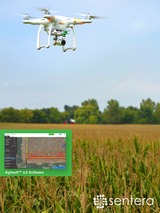
AgVault by Sentera is an image and data management mobile, web, and desktop platform that’s with the farmer at the office, and in the field. AgVault handles all of a farmer’s aerial color, NIR, NDVI and NDRE data, while AgVault Mobile tracks crop growth stages, weeds, compaction, storm damage and more.
Effortlessly fly a DJI Mavic, Phantom 4, Phantom 3 or Inspire drone with the AgVault Mobile autonomous flight capability for iOS devices.

AgVault Mobile triggers the sensor at the exact moment needed to collect precise data from every inch of a field, and the software works with many of the best ag drones available today.
Farmers actively use some 26 apps on a regular basis. The above apps are just a few. New technologies such as the Internet of Things and Cloud Computing are expected to leverage this development and introduce more robots and artificial intelligence in farming, using massive volumes of data with a wide variety that can be captured, analyzed and used for decision-making.
The content & opinions in this article are the author’s and do not necessarily represent the views of AgriTechTomorrow
Comments (0)
This post does not have any comments. Be the first to leave a comment below.
Featured Product

