Purdue researchers acquire and analyze data through AI network that predicts maize yield

Artificial intelligence (AI) is the buzz phrase of 2024. Though far from that cultural spotlight, scientists from agricultural, biological and technological backgrounds are also turning to AI as they collaborate to find ways for these algorithms and models to analyze datasets to better understand and predict a world impacted by climate change.
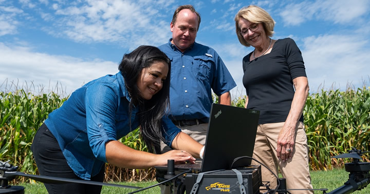
In a recent paper published in Frontiers in Plant Science, Purdue University geomatics PhD candidate Claudia Aviles Toledo, working with her faculty advisors and co-authors Melba Crawford and Mitch Tuinstra, demonstrated the capability of a recurrent neural network — a model that teaches computers to process data using long short-term memory — to predict maize yield from several remote sensing technologies and environmental and genetic data.
Plant phenotyping, where the plant characteristics are examined and characterized, can be a labor-intensive task. Measuring plant height by tape measure, gauging reflected light over multiple wavelengths using heavy handheld equipment, and pulling and drying individual plants for chemical analysis are all labor intensive and expensive efforts. Remote sensing, or gathering these data points from a distance using uncrewed aerial vehicles (UAVs) and satellites, is making such field and plant information more accessible.
Tuinstra, the Wickersham Chair of Excellence in Agricultural Research, professor of plant breeding and genetics in the department of agronomy and the science director for Purdue’s Institute for Plant Sciences, said, “This study highlights how advances in UAV-based data acquisition and processing coupled with deep-learning networks can contribute to prediction of complex traits in food crops like maize.”
Crawford, the Nancy Uridil and Francis Bossu Distinguished Professor in Civil Engineering and a professor of agronomy, gives credit to Aviles Toledo and others who collected phenotypic data in the field and with remote sensing. Under this collaboration and similar studies, the world has seen remote sensing-based phenotyping simultaneously reduce labor requirements and collect novel information on plants that human senses alone cannot discern.
Hyperspectral cameras, which make detailed reflectance measurements of light wavelengths outside of the visible spectrum, can now be placed on robots and UAVs. Light Detection and Ranging (LiDAR) instruments release laser pulses and measure the time when they reflect back to the sensor to generate maps called “point clouds” of the geometric structure of plants.
“Plants tell a story for themselves,” Crawford said. “They react if they are stressed. If they react, you can potentially relate that to traits, environmental inputs, management practices such as fertilizer applications, irrigation or pests.”
As engineers, Aviles Toledo and Crawford build algorithms that acquire massive datasets and analyze the patterns within them to predict the statistical likelihood of different outcomes, including yield of different hybrids developed by plant breeders like Tuinstra. These algorithms categorize healthy and stressed crops before any farmer or scout can spot a difference, and they provide information on the effectiveness of different management practices.
Tuinstra brings a biological mindset to the study. Plant breeders use data to identify genes controlling specific crop traits.
“This is one of the first AI models to add plant genetics to the story of yield in multiyear large plot-scale experiments,” Tuinstra said. “Now, plant breeders can see how different traits react to varying conditions, which will help them select traits for future more resilient varieties. Growers can also use this to see which varieties might do best in their region.”
Remote-sensing hyperspectral and LiDAR data from corn, genetic markers of popular corn varieties, and environmental data from weather stations were combined to build this neural network. This deep-learning model is a subset of AI that learns from spatial and temporal patterns of data and makes predictions of the future. Once trained in one location or time period, the network can be updated with limited training data in another geographic location or time, thus limiting the need for reference data.
Crawford said, “Before, we had used classical machine learning, focused on statistics and mathematics. We couldn’t really use neural networks because we didn’t have the computational power.”
Neural networks have the appearance of chicken wire, with linkages connecting points that ultimately communicate with every other point. Aviles Toledo adapted this model with long short-term memory, which allows past data to be kept constantly in the forefront of the computer’s “mind” alongside present data as it predicts future outcomes. The long short-term memory model, augmented by attention mechanisms, also brings attention to physiologically important times in the growth cycle, including flowering.
While the remote sensing and weather data are incorporated into this new architecture, Crawford said the genetic data is still processed to extract “aggregated statistical features.” Working with Tuinstra, Crawford’s long-term goal is to incorporate genetic markers more meaningfully into the neural network and add more complex traits into their dataset. Accomplishing this will reduce labor costs while more effectively providing growers with the information to make the best decisions for their crops and land.
About Purdue Agriculture
Purdue University’s College of Agriculture is one of the world’s leading colleges of agricultural, food, life and natural resource sciences. The College is committed to: preparing students to make a difference in whatever careers they pursue; stretching the frontiers of science to discover solutions to some of our most pressing global, regional and local challenges; and, through Purdue Extension and other engagement programs, educating the people of Indiana, the nation and the world to improve their lives and livelihoods. To learn more about Purdue Agriculture, visit this site.
Comments (0)
This post does not have any comments. Be the first to leave a comment below.
Featured Product

